


Search
Search Criteria
Products meeting the search criteria

In Stock
Brand: Pix4D
Pix4DfieldsAdvanced agriculture mapping software for aerial crop analysis and digital farmingCaptureCollect images using a drone and any standard RGB or a selected multispectral camera like Parrot Sequoia+ and MicaSense RedEdge. Use our Pix4Dcapture app to easily plan and control your drone flight f..
In Stock
Brand: Pix4D
The leading photogrammetry software for professional drone mappingCaptureCapture RGB, thermal or multispectral images with any camera. If you are using a drone, automate flight and image-data transfer with the free Pix4Dcapture app. DigitizePix4Dmapper transforms your images into digital spatia..
In Stock
Brand: Pix4D
Pix4Dreact2D fast-mapping for emergency response and public safetyCaptureFly your drone to capture the images you need. Plan an optimized and automated flight with an app like Pix4Dcapture for Parrot and DJI drones. ProcessCombine large numbers of images in minutes with Pix4Dreact. Create measu..

In Stock
Brand: Pix4D
Bridge the gap between photogrammetry and CADCaptureCapture images or point clouds with a drone or any laser scanner. When using a drone, automate and optimize your flights with the free Pix4Dcapture mobile app.ModelTransform your images into digital point clouds, and import them into Pix4Dsurvey. W..
In Stock
Brand: Pix4D
The leading photogrammetry software for professional drone mappingCaptureCapture RGB, thermal or multispectral images with any camera. If you are using a drone, automate flight and image-data transfer with the free Pix4Dcapture app.DigitizePix4Dmapper transforms your images into digital spatial mode..
Brand: Pix4D
Learn how to use Pix4D Mapper with their online training course.Includes:Pix4Dmapper Essentials online coursePix4Dmapper Essentials certification ExamPix4Dmapper In-depth online course..
Brand: Pix4D
The leading photogrammetry software for professional drone mappingCaptureCapture RGB, thermal or multispectral images with any camera. If you are using a drone, automate flight and image-data transfer with the free Pix4Dcapture app.DigitizePix4Dmapper transforms your images into digital spatial mode..
")
")
Brand: Pix4D
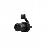
PIX4D Vidoc With Software for AEC Hardware bundle, (PIX4Dmatic, PIX4Dsurvey, PIX4Dcloud Advanced yearly licenses)The viDoc RTK rover is a device that can be mounted onto Apple iPad Pro or Apple iPhone 12/13. The rover, synchronized with PIX4Dcatch, geotags images with RTK accuracy in real-time, whil..