


Multicopter Warehouse is now a Pix4D Reseller

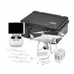
We are very happy to announce that Multicopter Warehouse is now an authorized Pix4D reseller. This new partnership with Pix4D allows us to offer a complete end-to-end mapping and surveying solution to our customers. Multicopter Warehouse can provide the entire suite of Pix4D products and support plans while our focus will be on two main products that are geared more towards our current customer base.
Pix4Dmapper
The leading photogrammetry software for professional drone mapping.
There is simply no better solution for mapping and analysis than Pix4Dmapper. Pix4Dmapper transforms your images into digital spatial models. Seamlessly process your projects using the cloud or the desktop photogrammetry platform. Measure distances, areas, and volumes. Extract elevation profile data and perform virtual inspections.
Pix4Dreact
2D fast-mapping for emergency response and public safety
Fly your drone to capture the images you need. Plan an optimized and automated flight with an app like Pix4Dcapture for Parrot and DJI drones. Combine large numbers of images in minutes with Pix4Dreact. Create measurable 2D maps in the field or back at base. With Pix4Dreact’s simple tools, identify and measure points of interest, mark and evaluate your maps while on the ground to provide powerful data needed to take action. Export your maps to ensure teams and decision makers are provided with effective information when it’s needed most. With up-to-date maps, gain precious time, improve safety and reduce costs when responding to an evolving situation.
If you would like to get pricing or more information on Pix4D product, please contact us today.