


Search
Search Criteria
Products meeting the search criteria
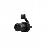
.1-250x250h.jpg "DJI Care Refresh (Zenmuse X4S)")
Brand: DJI
DJI Care Refresh is an effective, comprehensive warranty for DJI products, offering you greater peace of mind every time you fly. Click here.
Please Note:
For a small additional charge, DJI Care Refresh offers up to two replacement units within one year.
If you are purchasing DJI C..


Brand: DJI
Overview
Specifically made for the Zenmuse X4S, this ND filter reduces the amount of light coming into the sensor. It gives you the freedom to create your own work by allowing more control of the camera's aperture, exposure time and sensor sensitivity settings.
Put more simply, the ND filter..

In Stock
Brand: Pix4D
Pix4DfieldsAdvanced agriculture mapping software for aerial crop analysis and digital farmingCaptureCollect images using a drone and any standard RGB or a selected multispectral camera like Parrot Sequoia+ and MicaSense RedEdge. Use our Pix4Dcapture app to easily plan and control your drone flight f..
In Stock
Brand: Pix4D
The leading photogrammetry software for professional drone mappingCaptureCapture RGB, thermal or multispectral images with any camera. If you are using a drone, automate flight and image-data transfer with the free Pix4Dcapture app. DigitizePix4Dmapper transforms your images into digital spatia..
In Stock
Brand: Pix4D
Pix4Dreact2D fast-mapping for emergency response and public safetyCaptureFly your drone to capture the images you need. Plan an optimized and automated flight with an app like Pix4Dcapture for Parrot and DJI drones. ProcessCombine large numbers of images in minutes with Pix4Dreact. Create measu..

In Stock
Brand: Pix4D
Bridge the gap between photogrammetry and CADCaptureCapture images or point clouds with a drone or any laser scanner. When using a drone, automate and optimize your flights with the free Pix4Dcapture mobile app.ModelTransform your images into digital point clouds, and import them into Pix4Dsurvey. W..